
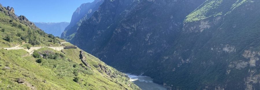
This is Tiger’s Leap Gorge, located in the Yulong Mountains of Yunnan Province, China. Here the Jinsha (Yangtze) River cross a zone of rapid rock uplift and erosion, carving a steep and precipitous canyon at a rate of about a centimeter per year. The surrounding peaks tower over 3 km above the river.
Author: meoskin

Here I am pointing at an abrupt transition from bouldery alluvial-fan conglomerate to marine sandstone near the base of the Fish Creek-Vallecito basin. This marks the flooding of marine water into the Salton Trough about 6.5 Million years ago, into what was probably a closed sub-sea level basin at that time. I think it would have been amazing to witness this event.
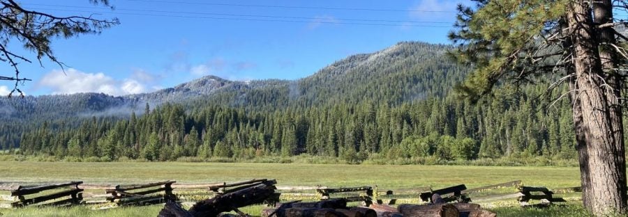
I am the faculty director for the Lassen Field Station, one of the newest additions to the University of California Natural Reserve System. Above is the view of Battle Creek Meadow from the staff campground at the Park Headquarters, where our field station is currently based. This is where I am now teaching our summer field course (GEL 110A). Next class to be taught here will be in summer, 2026.
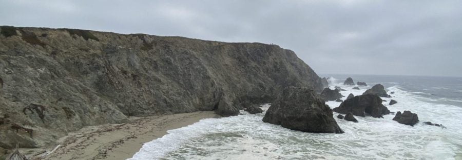
The photograph above was taken at Bodega Head in Sonoma County. Dramatic cliffs of granite rise up out of the Pacific Ocean here. This is the northernmost exposed outcrop of granitic rocks west of the San Andreas Fault. Slip on the fault juxtaposes rocks sliced off the Sierra Nevada batholith against the Franciscan subduction complex. But what about the rocks that were between the Sierra Nevada and the Franciscan complex? Shouldn’t those have been translated north also? Instead the granitic rocks meet the sea here, and that forearc basin is missing! This is a clue to events prior to formation of the San Andreas Fault that took place in Southern California during subduction.